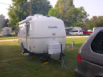
We’re going to leave our Casita at home and travel to New Mexico tomorrow.
Sandi’s long-time girl friend, Dawn, recently moved to New Mexico.
I looked the address up on Google maps. It has a nice view of Sandia Peak in the distance.

The Geology of the Area
Sandia Peak is part of the Sandia Range. They are fault block mountains, meaning that they were pushed up from deep in the underlying rocks. The force that caused the faulting was continental drift. Just to the east of the Sandia Mountains, the terrain flattens out into a was once an ancient seabed.
To the west of Sandia Peak is the city of Albuquerque, NM. It sits in a deep depression on both sides of the Rio Grande. The depression is known as the Rio Grande Rift Valley.
A continental rift is geology is a place where the Earth's crust and lithosphere are being pulled apart and is an example of extensional tectonics. Click here for an explanation of a Rift Valley.
The Rio Grande Rift occurred about 35 million years ago and runs from Colorado to El Paso, Texas. Some people believe the Rio Grande caused the deep valley; but quite the contrary, the great river only uses the rift.
Will the rift continue to widen and sink? Geologists believe the rift is stable, at least for the moment.
Flanking the Rio Grande Rift on the east and west is the San Juan Volcanic Field. This field includes a large part of Northern New Mexico and Southwestern Colorado. This field is the source of rich mineral, silver, and gold deposits.
The most recent volcanic activity in New Mexico was south of the Sandia Range near Socorro. A near perfect cinder cone lies between Raton, NM, and Clayton, NM. It is the 60,000-year-old Capulin Mountain.
Capulin is part of the Capulin Mountain National Monument. It features a road to drive to  the summit. The last time Sandi and I went to Capulin, she became afraid and would not go into the crater. Ha Ha! There is also a trail around the crater rim. The crater rim trail provides a spectacular view of the surrounding topography. Every peak in the area is an extinct volcano.
Further north of Albuquerque and to the west of Santa Fe is Valles Caldera. The caldera is a 12-mile-wide crater formed from a collapsed volcanic cinder cone. The once secret atomic energy research site of Los Alamos sits on the slops of this Supervolcano class of volcano.
From my own observations, the volcanic eruptions have left long fingers of lava flows, huge deposits of of volcanic ash and thick formations of volcanic tuft. It’s a spectacular landscape.
History of Albuquerque
According to Wikipedia:
The city was founded in 1706 as the Spanish colonial outpost of Ranchos de Alburquerque; present-day Albuquerque retains much of the Spanish cultural and historical heritage.
Albuquerque was a farming community and stra-tegically located military outpost along the Camino Real. The town of Alburquerque was built in the traditional Spanish village pattern: a central plaza surrounded by government buildings, homes, and a church. This central plaza area has been preserved and is open to the public as a museum, cultural area, and center of commerce. It is referred to as "Old Town Albuquerque" or simply "Old Town." "Old Town" was sometimes referred to as "La Placita" ("little plaza" in Spanish).
The village was named by the provincial governor Don Francisco Cuervo y Valdes in honour of Don Francisco Fernández de la Cueva, viceroy of New Spain from 1653 to 1660. One of de la Cueva's aristocratic titles was Duke of Alburquerque, referring to the Spanish town of Alburquerque. The first "r" in "Alburquerque" was dropped at some point in the 19th century, supposedly by an Anglo-American railroad station-master unable to pronounce the city's name correctly. Some New Mexicans still prefer the spelling Alburquerque; see for example the book by that name by Rudolfo Anaya. In the 1990s, the Central Avenue Trolley Buses were emblazoned with the name Alburquerque (with two "r"s) in honor of the city's historic name
Albuquerque is also the site of the Sandia Atomic Research Laboratories.
Sandia Base was located at Albuquerque. I was one of three nuclear storage facilities along with Medina Base, south of San Antonio, TX, and Killeen Base, near Killeen, TX.
According to Wikipedia:
Sandia Base was from 1946 to 1971 the prin-cipal nuclear weapons installation of the United States Department of Defense. It was located on the southeastern edge of Albu-querque, New Mexico. For twenty-five years, the top-secret Sandia Base and its subsidiary installation, Manzano Base, carried on the atomic weapons research, development, design, testing, and training commenced by the Manhattan Project during World War II. Fabrication, assembly, and storage of nuclear weapons was also done at Sandia Base. The base played a key role in the United States nuclear deterrence capability during the Cold War.


 trade route was extended from Santa Fe to Missouri. Later, the trail served as an invasion route during the Mexican-American War.
.jpg) During the heyday of the Santa Fe Trail, the plaza was the central governmental area as well as a place of trade. Today the business of Santa Fe’s Plaza is curio shops, art galleries, eateries, and restaurants.
During the heyday of the Santa Fe Trail, the plaza was the central governmental area as well as a place of trade. Today the business of Santa Fe’s Plaza is curio shops, art galleries, eateries, and restaurants.


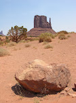
 They are learning to adapt to the desert environment. Water is very precious. Their yard consists of stone pebbles. A few desert shrubs they own are watered by drip irrigation. Color of the landscape is a beautiful desert pastel. off in the distance is the beautiful Sandia Peak.


